Saturday, November 3, 2018

Northwestern Argentina--Salta and Cafayate

Rock formations outside Cafayate

We started our day with a flat tire—probably no surprise given the rocky road we traversed yesterday.  Cafayate has no Hertz office, no gas station that fixes tires and no tire store.  So, I called our travel agent who called Hertz who called someone in Cafayate who said he could help us get a new tire for our 160 mile drive to Salta.  When we pulled up to the repair shop, the guy Hertz called was waiting for us, so I called our travel agent, who talked to him in Spanish and off he went to get the replacement tire.  Two hours after we first attempted to leave, we were on the road to Salta, feeling much happier with 2 tires that held air.
red rocks near Cafayate
Cafayate is a small town, center of one of Argentina’s major wine regions.  It is a bit nondescript, but does have a wine museum and a pretty plaza lined with restaurants and a few shops. 
jumbled rocks and colors
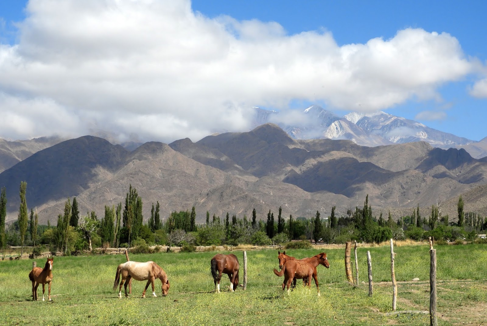
The real lure of Cafayate is not just the fine wineries here and the beautiful wine hotel where we stayed last night, but also the spectacular drive between Cafayate and Salta.  I know I’ve used that word a lot in this part of the Andes, but it’s accurate, as the mountains and formations you drive through all over this region are truly stunning in their shapes, geology, massiveness and colors. 
This drive equals the others in making you marvel at what the earth has done to itself.  We drove through huge canyons and deep gorges, stopping to photograph the scenery.  When we bring a group here, we will try to get a naturalist/geologist to come with us to explain the breathtaking world we’ll drive through.
Patios del Cafayate, lovely wine hotel

Once back in Salta, we found our way through the traffic and potholes to the beautiful central plaza, but didn’t have time to do any sightseeing as we were already late, and couldn’t find a place to park anyway.  It was 2:30 and we were hungry, so when we did finally find a parking place, we were on the lookout for a cafĂ©.  A woman beckoned us into her courtyard.  Inside, she had turned her small home into a restaurant with 5 tables in the former living room/kitchen and 1 table in the former interior courtyard, now the kitchen.
uplifted red rocks
They made space for us and brought us delicious empanadas.  We wanted water, so one of the boys serving patrons (probably a son) went off to the nearest store and bought a large bottle for us.
Of course, we needed the bano after a long drive.  The lady took us into the rest of her house, where her family lives, to use their bathroom.  But, first, she had to protect us from a very large and very old dog who only liked her and growled quietly all the time we were there.  The bathroom sink didn’t work, but everything else did, so we were happy even if we disturbed the dog’s rest.
House of Jasmine, our estancia hotel in Salta

Now we’re at the Salta airport waiting for our very delayed flight to Buenos Aires.  Of course, Aerolineas said the flight was on time until just about departure time, when they announced it would be 2 hours late.  Right now, the time we were supposed to leave, they’re boarding their earlier flight to BA, also 2 hours late.  Being on time is not a priority for Aerolineas, as we’ve found when we’ve flown them in the past.  It’s why I’ve decided never to trust a same-day connection to our flight home, even with 10 or 12 hours to do so.  We’ve had too many close calls and today we would have missed our flight home.  So, when we eventually get to Buenos Aires, we’ll spend what’s left of the night and leave tomorrow night for home.  We're excited to be staying once again at our favorite hotel in Buenos Aires, the Hub Porteno, a very small, beautiful hotel, with huge suite rooms on a quiet street in the Recoleta district.  We recommend it to everyone.
valley on the way to Salta


Thursday, November 1, 2018

Salta and its stunning province

21000 foot peaks above Cachi
Salta has been one of the places in Argentina we've always wanted to visit.  We drove to a lovely hacienda just outside Salta from Purmamarca and, after a long day, luxuriated in its peaceful grounds looking up to the towering mountains beyond.  On a walk around the hacienda, we saw many small owls, buhos, which are ground dwellers.  They are beautiful little creatures.
buho
Tomorrow, we'll visit the city of Salta before flying to Buenos Aires for one night and then returning home.  What a great trip this has been.  I'm sure we will be offering a variation of it to our fellow travelers soon.
horses near Cachi
Yesterday, we drove to Cachi, a mountain town about 3 hours from Salta.  To get there, we drove up the Calchaqui Valley, and across the Lerma Valley, up and up and up a graveled road, rimmed by steep mountainsides and cliffs, around hairpin turns for miles and miles until we topped out about 11,500 feet and entered the Argentine altiplano, ringed by snow-capped peaks, many over 20,000 feet.  Late in the day, we reached Cachi and flopped into our hotel room in an old estancia in the most gorgeous setting, ready for some rest and good wine.
Cachi, like all the Andean villages we've visited and driven through on this trip, is an Indian town, rich in the culture of the Andes.  Tourists make day trips to Cachi from Salta, which would be a long day since you have to go both ways over this difficult road.  So, the town begins to move about 11:30 in the morning when the first tourist vans start to arrive.  It is very pretty and incredibly clean.  We wandered around before the tourists arrived and saw people sweeping the streets and shopkeepers and restaurant owners setting up for the visitors who have made their town quite prosperous.
In the area around Cachi, most of the homes used to be adobe.  Now, new homes of concrete or concrete block are being built, replacing the old adobe homes, which are given over to the animals.  Adobe walls line the dirt roads, but many are melting with each heavy rainfall, replaced by fence posts and wire.
old adobe house now used for animals
The area around Salta is big horse country.  Horses graze in the green grass next to every road, safely staked away from the traffic, and fill the fields around the houses.  Argentinians love polo and the horses reflect the importance of good breeding and good care to this sport.
new concrete house and fancy wall next to old adobe
Today, we left Cachi and drove down Highway 40, through the most amazing scenery.  The highway, itself, the major artery between Cachi and Cafayate, one of Argentina's wine regions, is butt-busting, bone-jarring, washboarded gravel for 140 kilometers of the 170 kilometers between Cachi and Cafayate.  It took us nearly 4 hours to negotiate the steep climbs, many washes and twisting turns, not getting out of third gear until the very end of the journey.
There are several wineries along the route, which is really surprising since hauling your wine to market must be a costly and jarring experience.  We drove for almost 3 hours before we found a small town that had a restaurant.  Otherwise, until the last 40 kilometers, there was nothing but a few adobe houses, 2 closed wineries, almost no cars, and lots of dust.  And, the most spectacular scenery.
uplifted rocks between Cachi and Cafayate
Rocks of pink, red, tan and gray hues have been thrust up in huge plates, standing almost straight.  They are bent and twisted into amazing shapes, thrusting themselves high up into the blue, blue sky.  The mountains rise above this fantastic array of giant shapes for mile after mile as the road winds up and over and through the rocks and ridges and dry river beds.  I would have taken many photos, but that would have added hours to our day and, besides, I had to focus on driving on this difficult and wondrous road cum highway.
red rock mountains along highway 40
Leaving the village where we had lunch, we picked up a young girl who was hitchhiking home, perhaps after school or work.  But, home was 35 kilometers up the road, so I hope she didn't have to do this twice every day.  Our Spanish isn't good enough for much communication and she spoke no English, but we were able to get her home nonetheless.  She tolerated my stops to take photos.
Tonight, we're staying at a beautiful wine estate in Cafayate before heading to Salta tomorrow.
wash and rocks along highway 40

Tuesday, October 30, 2018

Purmamarca, Argentina--what a setting!


Purmamarca, Argentina

Purmamarca, Argentina is an Indian village in one of the most spectacular settings in the Andes.  More on that in a minute.  It's streets are rocky and dusty, lined with old adobe or rock buildings full of shops and homes.  There isn't any sign of wealth here, but lots of creativity, music and sense of community, where everyone knows everyone else.
The town has a busy and colorful Indian market surrounding the town plaza and filling the streets that spread out from the square. 
Mid-day and late into the afternoon, tourists shop for the brightly colored handicrafts in the outdoor market and in the shops lining the streets.  We did not meet any other American tourists; they’re mostly Argentinians with some Europeans making their way to this remote area.  Consequently, not too many people speak English, but we were able to get by with our miserable Spanish because everyone was so kind.
market stall with dog

Yesterday afternoon, after waiting too many hours for our rental car to arrive in Purmamarca, we drove up the next valley over to Humahuaca, another Indian town.  We did not think it was worth the visit, though the valley itself was colorful and beautiful.  Purmamarca’s Indian market is much bigger and livelier and the magnificence of the mountains and the fascinating geology make it the more interesting place to visit.

Purmamarca has many restaurants, all with live music most of the day.  We went to one last night that was particularly popular, probably because the musician was exceptionally charming with a beautiful voice.  The diners loved him.
Today, we hiked about 3 ½ miles up a jeep road in the valley just behind Purmamarca, to the end of the road and a bit beyond, up a dry, pink wash.  It is hard to describe the beauty of this place.  The wildly contorted rocks are a giant painter’s palate, with pink, red, green, orange and white masses of color as you walk up the valley.  You can see similar rock formations just walking around the town, but nothing like the steep valley behind the village.  Several softer formations are heavily eroded into pinnacles and spikes and deep mini-gorges that catch the light and shadows.
Selena, the llama
There are a number of hotels in Purmamarca, none that are luxury level.  Ours had a pretty garden with adequate rooms and towels that had seen better days years ago.  Its biggest attraction is Selena, a sweet llama who resides at the hotel and keeps the grass mowed.  After many soft conversations, she finally came over to sniff my hand, which she found less than appealing.  Nevertheless, she kept sniffing and let me pet her ever so carefully for a split second.

I think I will let the photos describe this area because words can’t.  Not that the photos really show you the depth of the colors, but you’ll get the idea.


Purmamarca street and mountains beyond

Sunday, October 28, 2018

Crossing the high altiplano from Chile's Atacama Desert to Purmamarca, Argentina

crossing the altiplano high above the Atacama Desert

Today we drove across the high Andes from San Pedro de Atacama, Chile to Purmamarca, Argentina.  At our high point we were just over 15,800 feet and spent most of the drive between 13,500 and 15,000 feet.  It is a spectacular drive, starting with the climb from the Atacama to the passes in between the huge volcanoes towering over 19,000 feet.  There was little snow on the peaks because Chile is so dry that neither rain nor snow falls, even in the high mountains.
high, barren desert at 15,000 feet on Chilean side
On the Chilean side of the border, the altiplano is mostly barren, though the volcanoes have grass growing to at least 16,000 feet on their western flanks.  Head further east, though, and the volcanic rock changes, leaving the area devoid of vegetation.  As we continued east, across very high valleys, the volcanoes receded and the mountains, still over 16,000 feet, became more contorted from tectonic shifts in the earth.  Here, we began to see salt-rimmed lakes, bushes and grass as well as vicuna and llamas.
lakes and vegetation at high altitude as we drove east
All the llamas are owned by someone, primarily Andean Indian families, and are marked with tassels in their ears or sometimes paint on their hips (which doesn’t wash off because there is no rain).  They are beasts of burden, but also provide meat and hides to their owners.  Outside most of the Andean houses we saw today were piles of llama hides.
We reached the border about 9:15 in the morning and didn’t leave until 10:45.  If you go across the border between Puerto Montt and Bariloche, where there is just a shack with one person staffing it, you can get across in 15 minutes.  There must be something about the remote and very high border crossing we encountered today that requires excessive bureaucracy because it took a ridiculously long time. 
the ever-present llamas
There were 3 Chilean agents who had to approve us and our van leaving the country and more on the Argentine side to welcome us to Argentina.  And, the van and our driver and guide are already returning to Chile so it’s not as if they are going to overstay their visas.  Once all the paperwork was completed, we still had to have the car searched before we could get on our way.  I think this small bevy of officials has too little to do, though there were several dozen trucks
salt flats above Purmamarca
also trying to get across.
Once in Argentina, we crossed a large salt flat where great mounds of salt have been piled up, awaiting transport to a processing plant.  This appears to be a fun family outing as many families were playing on the salt flat, tasting the water in the evaporation ditches and enjoying the cool sunshine at 13,000 feet.
The road down to Purmamarca is long, very steep and very windy, with hairpin curves that almost completely double back on one another.  The uplifted rocks give the mountains a multitude of beautiful colors, which we are about to go out and inspect as we have now arrived in Purmamarca.  Many of the cliffs are conglomerate, so have eroded into giant pinnacles crowded together to make heavily indented cliffs.  Rain is obviously much heavier here than across the mountains because there are large, dry rivers that have clearly carried large amounts of rushing water and deeply eroded gorges of many colors.
the moon above the altiplano


Saturday, October 27, 2018

Lagunas Miscanti and Mineques, Reserva Nacional los Flamencos

Laguna Miscanti

 The Reserva Nacional los Flamencos covers a large area of the Atacama Desert and mountains and is home to 3 of the 4 species of flamingos.  It ranges from the salt flats, with remnants of salty lagoons, to the altiplano valleys at 14,000 feet, along with their 18,000 to 20,000 foot volcanoes surrounding them.
Laguna Mineques
Today we visited Lagunas Miscanti and Mineques, 2 beautiful lakes at 13,600 feet, separated from each other by a low ridge.  These lakes are salty, as you can see from the salty white beaches surrounding them.  It looks like they fill up with the snow runoff in the early spring and then recede in the extremely dry air of the desert.
lemon yellow grass and 19,000 foot peak
On our drive from San Pedro along the huge salt flat south of the town, we saw wild donkeys standing in the sun by the side of the road.  I’m not sure what they were doing right there since there was no vegetation.  I assume they eat the low bushes that grow up a bit higher.
Up on the high altiplano beneath the peaks, we saw, once again, lots of vicuna, blending in beautifully with the bright grass that grows very high.  This grass was more lemon yellow than golden, as we saw farther north around the geyser basin.  It grows up the mountainsides to at least 16,000 feet, providing a glow against the black backdrop of the volcanoes.
vicuna herd high on the altiplano

This is a big tourist mecca, so we were not the only ones enjoying a sparkling day.  Despite dust kicked up by cars and vans, the air is exceptionally clear.  Very few people actually live in the area.  We saw no homes above the village of Socaire, which is about 10,500 feet high and 40 miles from the nearest town to the north.   While you turn off the main paved road onto a dusty, washboarded dirt road to go to the lakes, the main road continues south to a very high pass leading into Argentina.  All day, we were within a few miles of the Argentine border, which we will cross tomorrow on our way to Purmamarca and Salta, Argentina.

San Pedro de Atacama


dogs and tourists, main street of San Pedro de Atacama
San Pedro de Atacama is the major town in this part of the Atacama, the only place where you can fill your car with gas and the only town with a significant tourist infrastructure.  There are dozens of restaurants and nearly 80 hotels, guesthouses and hostels.  Among them are several high-end luxury hotels, but most are geared towards the traveler needing cheaper places to sleep.
San Pedro's adobe church
This is a dusty desert town with unpaved, rutted streets, high adobe walls protecting the pretty homes, hotels and courtyards behind, hiding them from the noise, dust and people on the streets.  It reminds me of Taos years ago, a poorer version, but with the same charm of old adobe houses leaning slightly to one side, narrow alleys with shops and homes, and artisans filling the galleries with their creations.  It is an Andean Indian village that attracts people from all over the Andes countries and Chile to work for a time before moving on.  Many of the locals wear traditional dress, not for the tourists, but because it's what they prefer.
San Pedro homes
The place is filled with tourists.  It’s mostly a backpacker town, but the luxury hotels and the magnificence of the area attract high end tourists as well.  The streets are filled with young people, properly adorned with tattoos and piercings, wild hair atop sunburned faces, probably finding a good dose of drugs as well as alcohol readily available.  Like us, they are here to enjoy the astonishing beauty of the Atacama Desert and the high Andes to the east, towering over the village and the altiplano.
adobe wall protecting a hotel
The main street is a pedestrian street, unpaved, filled with tourists, locals, storekeepers, dogs.  The dogs that are wearing scarves or ribbons or yarn around their necks have owners and are the fortunate ones.  Most of the dogs are on their own and hang out next to the restaurants where they get lots of scraps.  They are in pretty good shape and are very gentle, loving any pet they can get.  Some of the strays clearly have patrons whom they greet with licks and jumps when they appear on the street.  I’m sure they would love to go home with them also.
wall outside hostel
San Pedro plaza

I love the adobe walls with their varied designs and warm colors.  Most are in need of maintenance, but the influx of tourist money is enabling some property owners to repair and upgrade their buildings.  One person who works at our hotel told me it is very expensive to live in San Pedro.  The more tourist demand there is, the more this will be a problem.  And, there just isn’t any place around the town for a workforce to live.


Friday, October 26, 2018

Valle del Arcoiris (Rainbow Valley), Atacama Desert

looking across the high plateau to the volcanoes beyone

San Pedro de Atacama, though small, is one of the larger towns in the heart of the Atacama Desert.  Surrounding it, the desert is enormous, cut up by gorges, some very deep, wide canyons and broad valleys.  The colors of the desert rock are warm, salmon to rose pink to mauve, shot through with white, gray, green and black rocks.  The volcanoes beyond are dark gray to deep purple, with shots of snow on their higher reaches.
colorful rocks in Valle del Arcoiris

Today, we drove northwest out of San Pedro, climbing high up onto the plateau above the town (high point of 11,500 feet) and diving down precipitous grades through steep gorges and wide canyons to the Valle del Arcoiris (Rainbow Valley), to hike and see its multi-colored rock formations.  It is an astonishing place, a series of deep canyons with jagged walls backed by gray-green mountains. 
side valley, Valle del Arcoiris
You can see that the area has been beset by huge upheavals in the earth because the rock plates are contorted and thrust up nearly vertically.  Erosion has carved deep gashes in the softer rock.  Different kinds of rock from different eras blend together with their multiple colors—green, reddish brown, black, white, powder blue, warm gray.  Some of the rock looks like it has been extruded during volcanic eruptions, which obviously were frequent and massive here eons ago.
looking at Valle del Arcoiris from side valley
We hiked up the jeep road to several rugged side canyons, to the point where the road has been blocked off at the entrance to a steep valley.  High up the valley, we stopped to listen.  There was no one else there.  It was absolutely quiet.
llama in Valle del Arcoiris mildly interested in me

Walking back to our car, a well-marked trail led off to a canyon that paralleled the main valley.  It was full of llamas who looked at me with mild interest, but mostly kept munching on the bushes that grow there. 
We decided to continue on to the village of Rio Grande, at the bottom of a very deep gorge with a river running through it.  Though the road from the main highway has been paved very recently, it is still a daunting, but beautiful, drive.  Once you arrive at the edge of the gorge, you descend on a very narrow road, somewhat like the Independence Pass road in Colorado, peering over the cliffs on one side to the river several thousand feet below.  The road is very windy and very steep, so we stayed in second gear and crept down to the bottom, where the road turned into a single track that goes out the other side of the gorge and, ultimately, to a graveled road leading back to San Pedro.  I would not enjoy this road in a winter snowstorm.
gorge above San Pedro de Atacama